Barva Volcano: They Call It Dormant, but It's Not Dead
Costa Rica's third-highest volcano has no confirmed eruption in historical times, yet hot springs and hydrothermal activity persist: it's sleeping, not extinct.
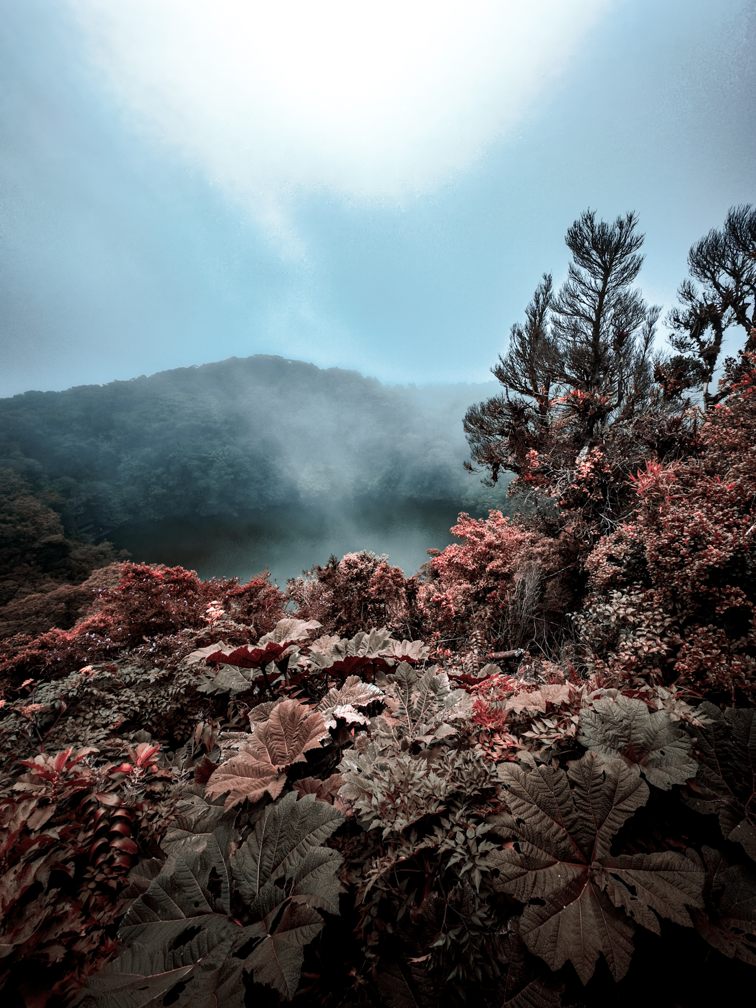
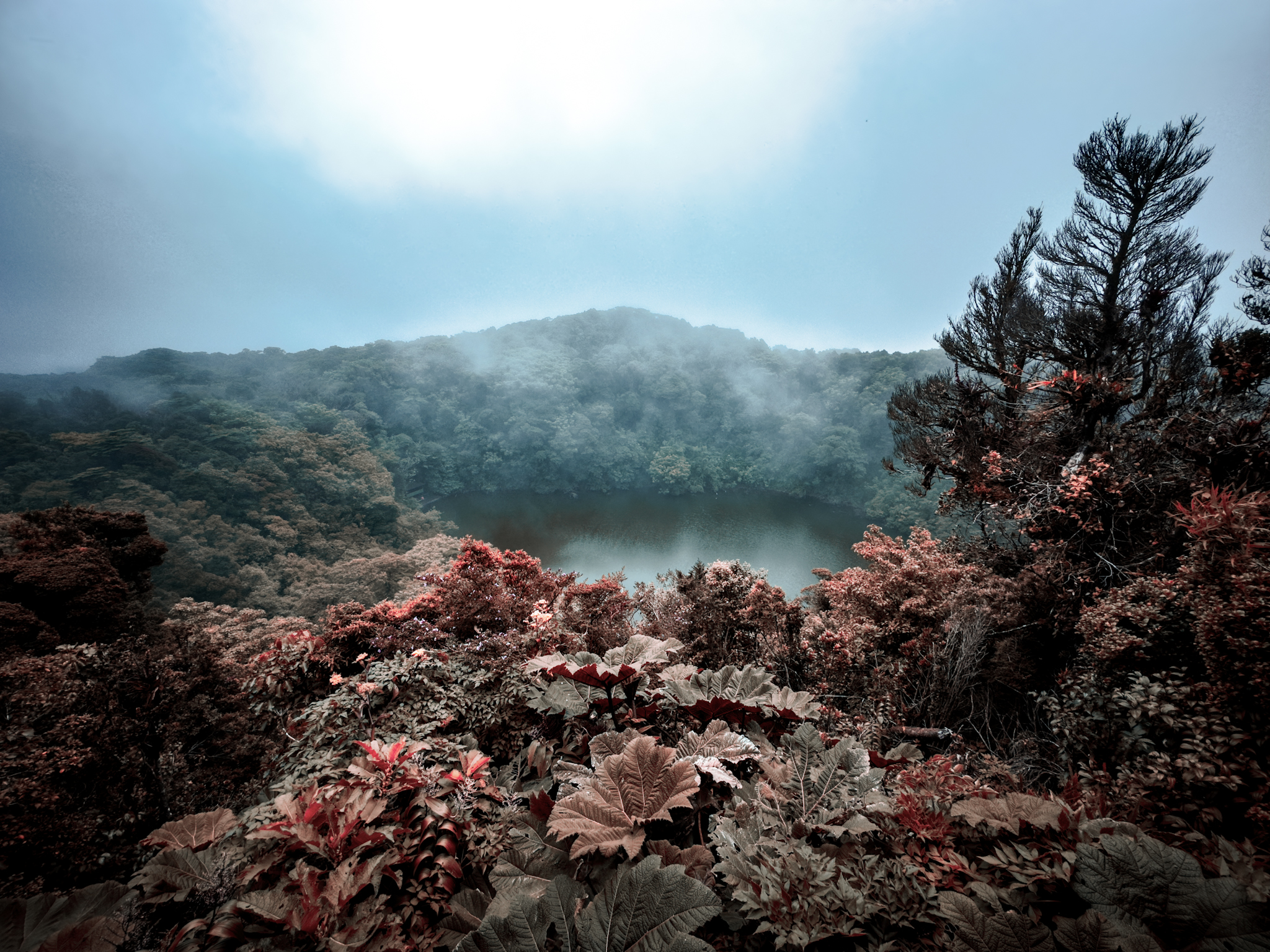
The first time you peer into Barva's crater, you almost never see the bottom. Cloud forest mist drifts in and out of the funnel, and when it parts for a moment, it reveals an almost perfectly circular lagoon — dark and still — at nearly 2,900 meters above sea level. Plenty of people describe it as the crater of "an extinct volcano." The word isn't quite right.
One volcano, three peaks and a crater lagoon
Barva rises 22 km north of San José, in Heredia, and at 2,906 meters it is Costa Rica's third-highest volcano, after Irazú (3,432 m) and Turrialba (3,340 m).1 It isn't a clean cone but a complex volcano: its broad summit has three main peaks, and that's where the name locals in the Central Valley have long used comes from — Las Tres Marías.1
It is also one of the largest volcanoes in the country, with gently sloping flanks that descend toward the Caribbean. Its main crater is filled by the Barva Lagoon: roughly 70 meters across, around 8.6 meters deep, and with an average temperature near 11 °C.2
"Dormant" is not the same as dead
Here's the nuance that usually gets lost. The Smithsonian's Global Volcanism Program — the world's reference scientific database — records no confirmed eruption of Barva in historical times. But it does document a major Plinian eruption at the start of the Holocene, some 8,000 years ago, and it describes hot springs near Porrosatí and the summit of Gongolona, along with sulfur vapor and mineral deposits in the landslide scars on its slopes.1
In geology, 8,000 years is nothing. A volcano without historical eruptions but with active hydrothermal features is not an extinct volcano: it is a dormant one. The distinction matters, because "extinct" implies a system shut down forever — and that is not what the evidence supports.
There's another point worth clearing up. You'll often read that Barva "erupted in 1700." Several geologists believe that episode, rather than a true eruption, may have been damage caused by a strong earthquake. In other words: the date repeated in many guidebooks doesn't stand on firm ground.
The crater lagoons
The best known is the Barva Lagoon, in the main crater. In December 2002, a team of geologists from the National Seismological Network (UCR) measured its waters: they found a clear lagoon, 11 to 12 °C near the shore, with an acidic pH between 4 and 5.3
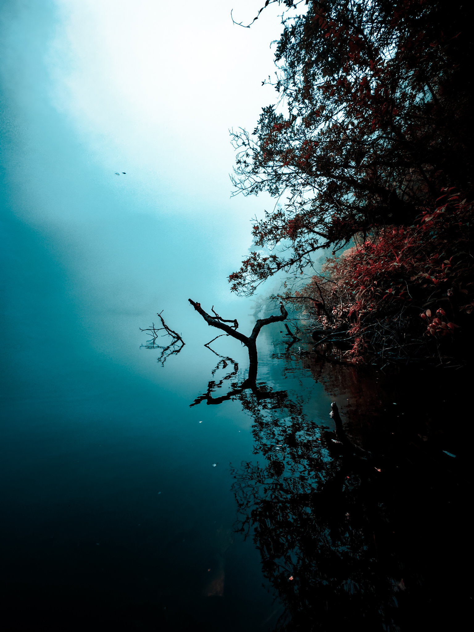
Two more lie nearby. Copey Lagoon is smaller — about 40 meters across — of marshy origin, with amber-tinted, murkier waters. Then there's Danta Lagoon, also of crater origin. All three share the same cold, humid cloud forest year-round.
The Central Valley's water tower
Barva is one of the last remaining stretches of wild high-elevation forest in the Central Volcanic Range — and that's far more than scenery. Its slopes work like a sponge: they capture rainfall and mist, recharge aquifers, and feed rivers and streams vital to the region's water supply.2
Put plainly: much of the water that reaches the Central Valley is born in the very mist that makes the crater floor so hard to glimpse.
:::separador:::
How to visit
Access is through the Barva Volcano Sector of Braulio Carrillo National Park. The entrance is about 3 km from the village of Sacramento, in the canton of Barva, Heredia.2 It's the park's highest and coldest sector, a world apart from the rainy Quebrada González along Route 32.
The sector has four trails — Cacho de Venado, Laguna Barva, Copey and Mirador Vara Blanca — totaling about 10 km, with drinking water, restrooms, picnic tables and a camping area open only Fridays through Sundays and holidays.2 The hike to the lagoon lookout and back takes between 3 and 4 hours.
Three things worth knowing before you go:
- Real cold. This is high-elevation cloud forest; mornings can drop to just a few degrees. Bring layers, a rain shell and, if you have them, gloves for the lookout.
- The final stretch of road. The last few kilometers are usually in poor shape; a high-clearance or 4x4 vehicle is recommended, especially in the rain.
- Confirm access. Hours and road conditions to the sector change often — in 2026 there were works that restricted weekend access — so check the official SINAC information and buy your ticket online before heading up.2
Barva isn't a volcano of smoking craters or dramatic spectacle. It's the opposite: a quiet, cold, cloud-wrapped place where the interesting things are the ones you don't see at first glance — the water, the geological story and the right word to describe it.
Place visited · Laguna Barva, Sector Volcán Barva, Parque Nacional Braulio Carrillo, Heredia